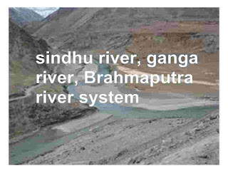
sindhu river system, Ganga Information and brahmaputra river
Himalayan river system is divided into three major river system.
1) sindhu river
• The Indus , also known as sindhu river, is the Western most of Himalayan rivers in India.
• It originates from a glacier near Bokhar Chu in the Tibetan region near Mansarovar lake.
• It is the one of the largest river basins of the world covering an area of 1165000 sq km (in India it is 321289 sq km) and a total length of 2880 km (in India 1114 km).
• In Tibet , it is known as Singi Khamban or Lion’s mouth.
• Important Indus Tributaries, which join Indus at various places , are Jhelum,Chenab, Ravi, Beas and Sutlej.
• According to Indus Water Treaty signed between India and Pakistan in 1960, India can utilize only 20% of the total discharge of Indus, Jhelum and Chenab.
Indus : --- ( source – Near Manasarovar; Length – 2880 km, Falls into – Arabian Sea).
Jhelum : --- ( source – Verinag, Length – 724 km, Falls into – Chenab).
Chenab : --- ( source – Bara Lacha Pass, Length – 1180 km, Falls into – Indus).
Ravi : --- (source – Near Rohtang Pass, Length – 725 km, Falls into – Chenab).
Beas : --- (source – Near Rohtang Pass, Length – 460 km , Falls into – Sutlej).
Sutlej : --- ( source – Manasarovar-Rakas Lake, Length – 1450 km, Chenab).
2) The Ganga Information about River System
• The Ganga system is the second major drainage system of India.
• Ganga Starting in the gangotri glacier near Gaumukh (3900 m) in the Uttarakhand,here is known as the Bhagirathi. At Devprayag, the Bharirathi, meets the Alahanda, hereafter, it is known as the Ganga.
• The Alaknanda has its source in the Satopanth glacier above Badrinath.
• The Alaknanda consists of the Dhauli and the Vishnu Ganga, which meet at Joshimath or Vishnu Prayag.
• It has 2525 km long of which 1450 km is in Uttarakhand and UP ,445 km in Bihar and 520 km in West Bengal.
• The left bank tributaries of Ganga are Ramganga, Gomti, Kali, or Sharda,Gandhak,Kosi,Mahanadi.
• Kosi is Called as ‘Sorrow of Bihar’ while Damodar is called as ‘Sorrow of Bengal’ as these cause floods in these regions.
• Hooghly is a distributory of Ganga flowing through Kolkata.
Ganga : ---- (Ganga Source – Gangotri glacier , Length – 2525)
Yamuna : ---- (Source – Yamunotri Glacier , Length -- 1376)
Chambal : ---- ( Source – Near Mhow, Length – 1050)
Ramganga : ---- (Source -- Garhwal district, Length – 596)
Ghaghra : ---- (Source -- Near Gurla Mandhata, Length -- 1080)
Son : ---- (Source – Amarkantak Plateau, Length -- 780)
Damodar : ---- (Source -- Chhotanagpur Plateau , Length – 541).
Gandak : ---- (Source – Tibet-Nepal border, Length – 425).
Kosi : ---- (Source – Sikkim-Nepal-Tibet Himalaya , Length – 730).
3) brahmaputra river
• It is One of the largest river of the world.
• It is Known as Tsangpo in Tibet, Dihang or Siang in Arunachal Pradesh, Brahmaputra in Assam and Jamuna in Bangladesh.
• Brahmaputra forms largest numberof riverine islands. Majuli is the largest riverine island in the world.
• The combined stream of Ganga and Brahmaputra forms the , the Sunderbans, covering an area of 58752 sq km. Its major part is in Bangladesh.
• Brahmaputra river is volume wise largest river of India, whereas lengthwise Ganga is the longest in India.Brahmaputra or Tsangpo : ---- ( Brahmaputra Originates – Rises in Chemayungdung glacier in the Kailash range, Total Length – 2900 km, Information – Mariam La Pass separates it from Mansarovar lake, Important tributaries are Subansiri, Kameng, Dhansiri, Dhansiri, Dihang, Lohit, Tista, Manas, etc).
